
Did this post take longer to load than usual? This post contains an abridged list of maps of Whidbey. Abridged, as in not unabridged, as in this isn’t the complete list and yet there’s enough to crash some computers – or at least use some patience with some of these sites. From the basics of shorelines, hills, and roads; to the scientific of hydrology, geology, and meteorology; to the preparedness for civil and natural disasters; to the playful and creative of tourism and the arts, as well as parks and places to play – whew. There are a lot of maps. And this is a short list. There’s a lot going on here. Geek out. Dive in. And maybe show some patience if your computer is a few years old, or your bandwidth is a but strained.
Sure, Google can map many things, but sometimes it is handy to use a map that’s already been built for a specific purpose. Almost all of these maps are from official sources. Let’s start with some County sites.
Note: The vast majority of the credit goes to various governmental and non-profit organizations that have worked hard on each of the maps. Your tax dollars and donations at work. Thanks to all. Also, some of the more interactive maps work best when looking at specific properties, but those will only have links to avoid showing such fine detail in a public blog.
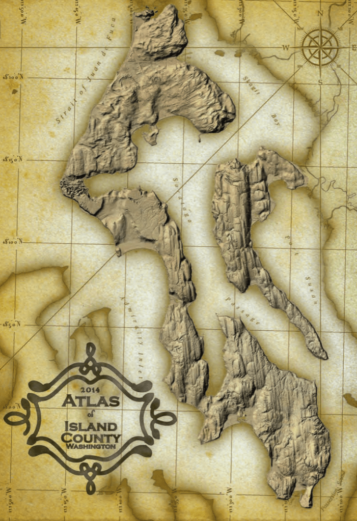
Possibly the prettiest showing the lines in the land left by the glaciers. (Glaciers Carved Whidbey)
This is the dry and useful stuff: Land use/planning, Parks, Transportation, Assessor, General maps.
This is even drier, but even more useful for folks trying to get something done: parcel, sheriff, land use, critical area, wells, permits, burn bans, county parks, shorelines, sales, service requests, conservation, water intrusion, stormwater, district boundaries, groundwater, traffic, restoration, elections
Living Here
Where and why and how are people living and building? Well, there are maps for that.
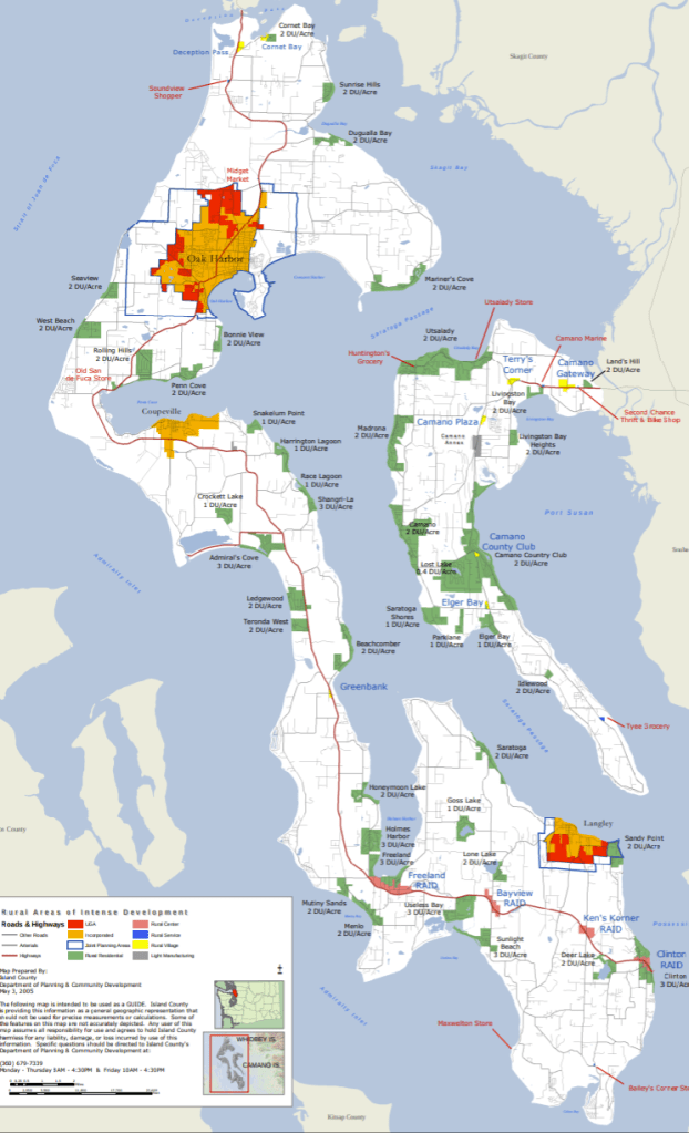
Rural Areas of Intense Development – Island County is a rural county, but it needs urban spaces, too – or at least Areas of Intense Development.
Parcel Maps – To get more specific and look at individual parcels.
Land Use Designations – Because not all land is the same.
Sales Info – As with many of the interactive maps, they may take a while to load, and you may have to do a lot of clicking and playing to find what you need.
Permits – It’s also possible to see permit activity, even for your own home.
Critical Area Map – A personal favorite because it is a good place to check for slopes and such, as well as wetlands and other areas of concern; i.e Critical Areas.
Transportation
County wall map with roads – It can be handy to have a road map that doesn’t include distracting ads or suggestions based on your search profile.

Road atlas – Want more detail? They got it.
How about Traffic – There’s data on how busy the county roads can be.
Buses – Click around Island Transit’s site for individual route maps. (Possibly a work in progress beacuse they are considering options.)
The icky parts
Crime happens, and there’s a map for that, too.
Burn Bans – because it is good to know if it’s okay to burn legally.
For some, noise is a feature; for others, not as much. There’s a map of airplane noise (which is possibly going to be updated. Stay tuned.) It is good to know about in either case.
Getting Scientific
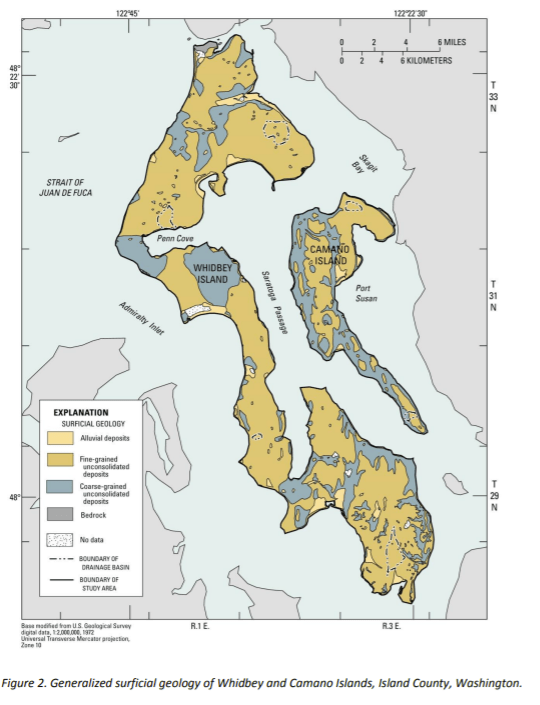
Geology – Whidbey is called The Rock by some, and for good reason. The island is known internationally within the geology community. Sadly, there isn’t one map that rules them all (but pass it along if you find it – found it, see below), because Whidbey is so long and skinny that it is part of a few other maps. Have fun stitching them together.
Topography – because the island isn’t exactly flat, as bicyclists discover

Geology Meets Hydrology – Within a USGS document are descriptions of the island’s hydrology, which also means understanding the geology. A good read for those inclined to see how the two are tied.

The environment around the island is dynamic enough that various government agencies have mapped out places sensitive to a few things worth being prepared for.
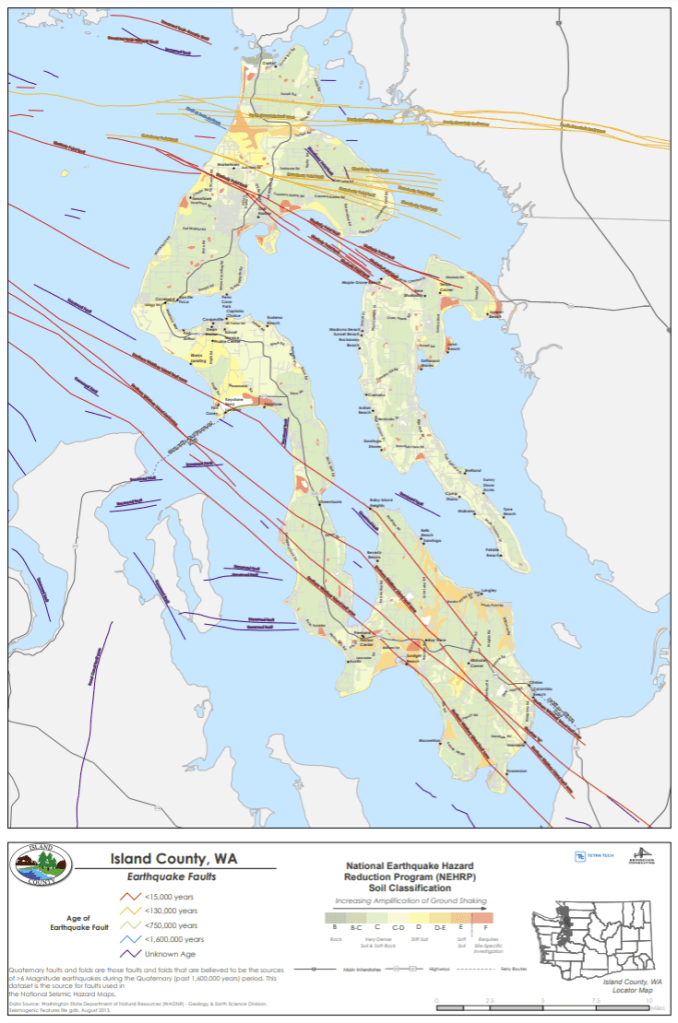
Earthquakes – The island shakes, occasionally. Welcome to Whidbey’s faults. (Whidbey Has Faults)
And, if you want the map of the recent quakes, Puget Sound Seismic Network has a site to see.

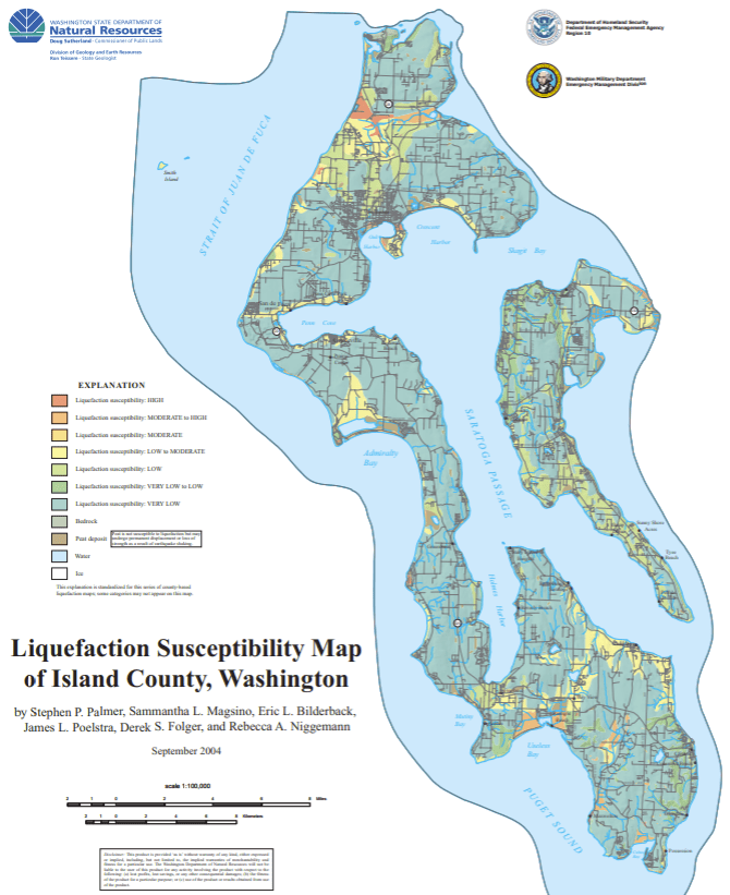
Liquefaction – As if shaking wasn’t enough, sometimes the ground gets looser when that happens.
Tsunami – We’ve been lucky lately, but historically they happen. (Tsunamis On Whidbey)

Water – We couldn’t be here without water, whether for drinking or living beside.
Wells – Where the wells are and some idea of the water they pump
Shoreline Designations – Because, just as all land isn’t the same, all shorelines aren’t the same.
Saltwater Intrusion – Because, despite our maps, saltwater and freshwater do mix.
There’s always more (remember, this is an abridged collection), but let’s turn to some lighter topics.
Yes, Whidbey has Parks and Recreation.
The County has a map. From the more federally-protected Ebey’s Landing to State parks like Deception Pass to South Whidbey to Possession Point, with County parks and city parks, there’s a lot to pick from.
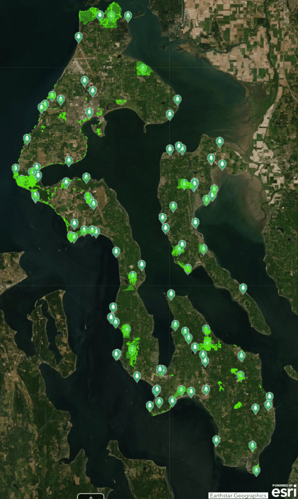
Whidbey Camano Land Trust is one example of an organization that is protecting places.

Gardening – Want to make something grow on your land?
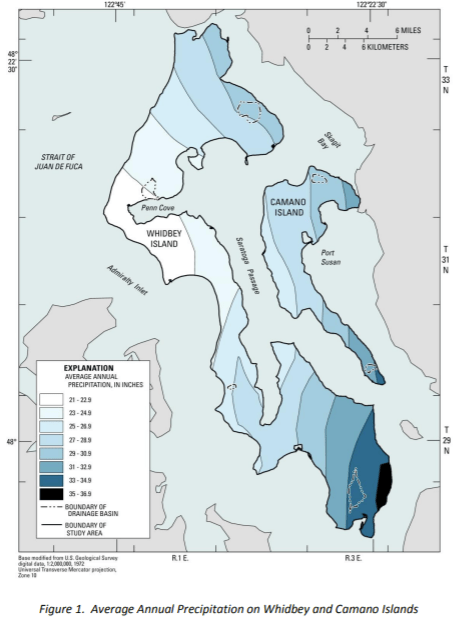
Rainfall – See where it’s nearly desert or a lot closer to rainforest.
Remember the geology section above that didn’t have an island-wide map of the soils? Evidently the same Conservation District study solved that issue. Here’s a map of the soil types.
Gardeners might just need to know more about the sunshine to complete their picture, but your neighbor’s trees may have a bigger influence.
and some ideas of where you can find help – that, and asking fellow gardeners.
More Recreation
And don’t forget tourism so you can find places you didn’t know about, or who visitors how to get to your favorite places. Check with the various Chambers of Commerce and WhidbeyCamanoIslands.com for a good general map, but also maps dedicated to art, farms, wine, distilleries, restaurants, lodging… Now, where’d I put those links…?
Whidbey Camano Tourism has a nice map.

Your favorite map isn’t on this abridged list? You’re welcome to add it in the Comments. Let’s see, there’s the one for beach access, trails, bicycling, schools, bird watching, historical sites including the railroad, …
