
Whidbey Island, where up is north, usually; down is south, kind of; and many people don’t know where the middle is. But…

The north end is defined by Deception Pass Bridge, except that the bit of basically road-less land to the east that juts up further.

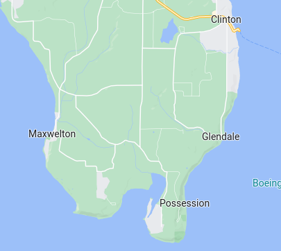
The south end is the Clinton ferry, except that it is a 15 minute drive to Lands End, just by Possession Point, the southern tip of the island.
Ah, but the middle. Which middle?
Some see Libbey Road as a border, which is near the end of Penn Cove.
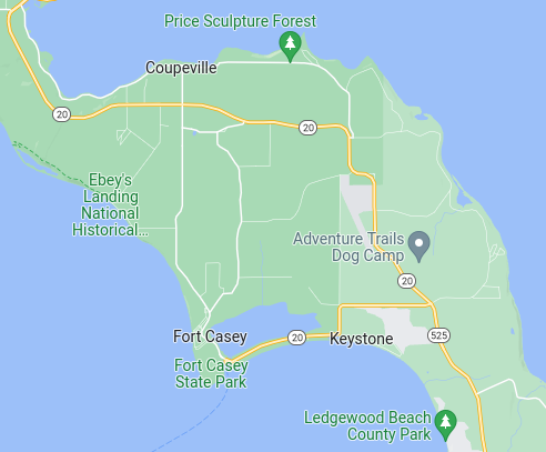
Some see Greenbank Farm as a border, possibly because there’s a long gap between the shops there and Coupeville.
The payphone booth at Classic Road has been called a border checkpoint. For some the surprise is that the phone booth actually works. (Thanks, Whidbey Tel.)
Take the average of the northern and southern latitudes and see that Coupeville really is the center of the island, at least N-S. Except that Admiralty Head may be a more appropriate point, and it is decidedly south of Coupeville.
There are also simple surprises, like Freeland and Langley. Follow the highway along 525-N and it can feel that Langley comes before Freeland, so Langley must be south of Freeland, but it is not. Downtown Langley is miles north of the highway, which basically runs to the west until turning north at Freeland.
We’ll use North and South to mark places and directions on the island, but Whidbey isn’t as simple as that. That may also make it more interesting. Up-island and down-island, perhaps? Drive around. Maybe take a bus tour. But making assumptions, well, sometimes it is handy to look at a map.
(Post partly inspired by Joe Menth. All maps from Google.)
