
It is hard not to notice the tides when you live by the sea. Whidbey Island may not get Bay of Fundy type tides (~52 feet), but 12 feet swings mean lots of water flowing in and out. Unless you’re 13 feet tall, that’s an issue – and an opportunity. Thanks to normal summer tides and some wobbling in the moon’s orbit there was an extraordinarily low tide on June 15, 2022. It was a good time to see how low the tides can go, and how much land they can expose when they do so.
That sounds easy enough. Buy a tide table, or maybe even a tide calendar, check the data and the graphs and time your walk to nature’s schedule.
Nope.
Yet again, Whidbey’s length makes things different.
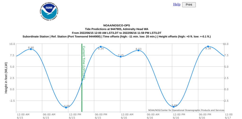
Two popular tide calendars are made by the same company, Evergreen Pacific. Why two? There are two because they publish one for Seattle (naturally), and one for Port Townsend (conveniently located at the entrance (and exit) for most of the water flowing into and out of Puget Sound. Some goes through Deception Pass creating phenomenal currents, but Puget Sound fills and empties largely from water passing through Admiralty Inlet. That subtle, quiet, and powerful wave of water crests and troughs at different times because Port Townsend and Seattle are forty miles apart. It takes time for water to flow. For June 15, 2022’s low tide:
Port Townsend 11:11 AM -3.9 feet
Seattle 12:09 PM -4.3 feet
But neither of those are on Whidbey. What about Whidbey?
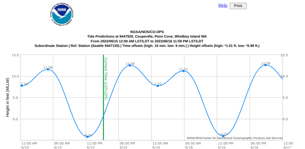
Whidbey’s tides vary even more because: 1) Whidbey is ~55 miles from tip to tip – by air, and 2) Whidbey’s bars, harbors, coves, and inlets contort the picture as the shoreline and the shape of the sea floor means different places fill and empty at different rates. Tides on the west side are different than tides on the east side because of Deception Pass, a more convoluted coast line, and which way to water flows as the tides are split as they work their way around the southern tip of the island. The distance from Admiralty Head (at the Coupeville Ferry terminal) to Penn Cove (and downtown Coupeville) is less than five miles, but the tides are deeper and later in Penn Cove – at least for June 15, 2022.
Fortunately, NOAA provides forecasts of over a dozen sites on the island. Here’s a partial list. (You’ll have to click around to find your specific site.)
Admiralty Head
Ala Spit
Bowman Bay (Fidalgo)
Bush Point
Cornet Bay
Crescent Harbor
Greenbank
Holly Harbor Farms
NAS
Penn Cove
Point Partridge
Sunset Beach
Sandy Point
Yokeko Point (Fidalgo)
Now all measurements are the same, but head to another of NOAA’s sites for those details.
Each site is different. Some harbors live up to the ‘harbor’ part of their name. Some bays are typified by names like Useless. Some tide flats are fine for casual wandering. Some require caution because of soft soils. (People have needed rescue from the mud. Uck and ugh.) Even walking along the beach benefits from checking for high tides to keep from being stranded at the opposite of the low tides.
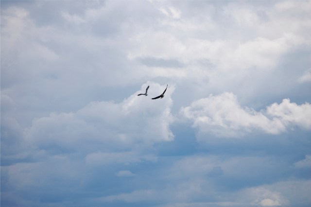
Check with fellow locals for local knowledge. There’s plenty to do: crabbing, clamming, fishing, wading, poking around tide pools, etc. Bird watching alone can occupy a day. It is possible in one sweep of a view to catch sight of gulls, herons, eagles, osprey, pelicans, and crows. Stay a while and watch which ones get along with the others (or not.)
It would be nice to show photos from all of the shores at low tide, but one person can only be at one place at a time. Here’s a quick video from Cultus Bay at the southern tip, actually beyond the southern tip of the island.
https://youtube.com/shorts/lX0BOIwpmVw?feature=share
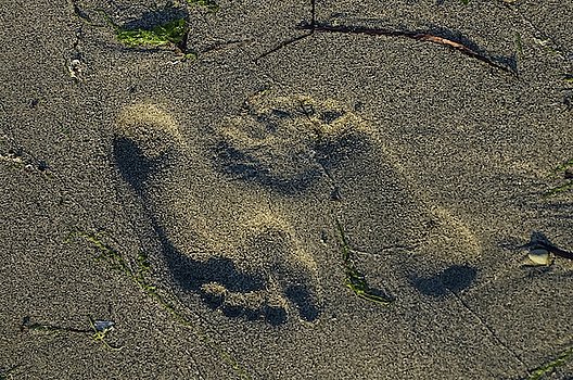
One other note, a barefoot beach walk can be romantic, but keep in mind that these are natural beaches complete with broken sea shells and the occasional sharp something that fell off a boat. Wearing shoes of some sort can avoid some of those issues. Oh yeah, and keep in mind that some homeowners own tideland rights, too. Respect, eh?
BTW It can also be worth knowing about low tides because they can cancel some ferry runs, or make it harder to load larger vehicles. Worth knowing.
