Did you want a White Christmas? How about a snowy Valentine’s Day? Better yet, the snow arrived in time to shut many things down just as a three-day weekend arrived. Bundle up. Light those candles and the fireplace. And make sure you have everything you need from the store for a romantic dinner, or the power going out, or both. Enjoy it now, because in a few weeks, maybe a few days, the rains will return.
This is a classic Puget Sound storm. Storm forecasts, especially for snow storms, are so fickle and fragile that there’s no reason to write about them until they arrive. For days the National Weather Service was teasing the possibility of snow, and very honestly mentioned that they weren’t sure what would happen. That’s typical, not because of a lack of skill but because of the chancy nature of winter weather.
The good news, the power stayed on. Enough snow fell to make the world pretty, until someone drives and creates necessarily slushy and dirty ruts. Well, people have to do what they have to do. Not everything can be done from home.
The problem with forecasting snow storms is different in and around Puget Sound. Across many parts of the world, a cold and wet mass of air flows into an area and drops inches or feet of snow. Forecasters can see it coming. Around Puget Sound, the moisture comes from one direction and the cold air comes from another and it isn’t obvious where they will meet. The moisture typically begins over the Pacific Ocean, a large place with few weather stations. Warm moist air coming in from the southwest is aimed towards the west coast of North America. Whether it is an atmospheric river or not, the moisture is like a garden hose flailing around without anything controlling it. Will the precipitation hit California, Oregon, Washington, British Columbia, or even Alaska? It is difficult to calculate.
For any storm approaching Washington State, the next issue becomes whether the water comes in south of the Olympic Mountains, directly at the mountains, or north of the mountain range. Those possible paths explain some of the variety of microclimates in the vicinity. Rain and wind can be intense in some areas while others sit in rain shadows. If the storm splits as it hits the mountains, eventually it will recombine on the downwind side and create the Puget Sound Convergence Zone, a tight area where storms can intensify. More difficulties for the Weather Service.
Cold air is needed, too. Just as moisture can arrive regardless of the temperature, cold air can arrive with or without moisture. Where they meet is where snow can form. An obvious source of cold air is the northern Pacific Ocean, basically Alaska and northern Canada. This time, we got that. And. Cold air from the interior of Canada poured into the US (obviously ignoring closed borders) and flowed to the west through gaps in the mountains.
Water from the southwest. Cold air from the north and the east. They all collided over Puget Sound and Whidbey Island. Snow.
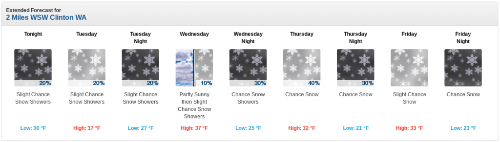
The forecast was for 3 to 7 inches, and as the air masses moved the forecast got broader rather than tighter, 2 to 9 inches. That cold air from the east was dry and countered the western movement of the rest. More reasons for the system to stall and for the snow to fall.
Whidbey Island has so many climates that one number does not suffice. Close to the water usually means slightly warmer. Higher is colder. North is closer to where those cold mountain winds swing in. South is closer to where the convergence zone forms. Good luck with that forecast, especially because the news stations are covering hundreds of miles, dozens of islands, and two mountain ranges.
As for what islanders have been mentioning on social media, many are interested in places to take the kids (and the adults) sledding.
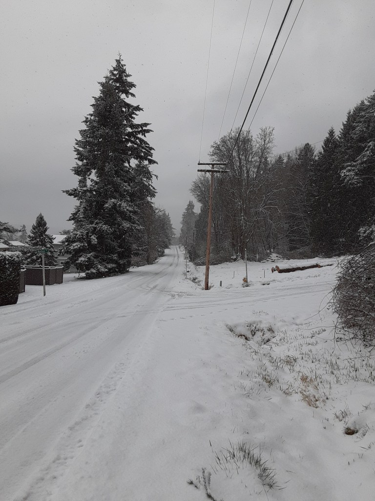
It would be ideal to drive around the entire island taking photos of the conditions throughout. Ideal for this post. Not ideal for anyone trying to use the roads. The island does have plows, but the island is spread out. They have a lot of work to do. The island also has neighborhoods where the neighbors take care of the roads, or not.
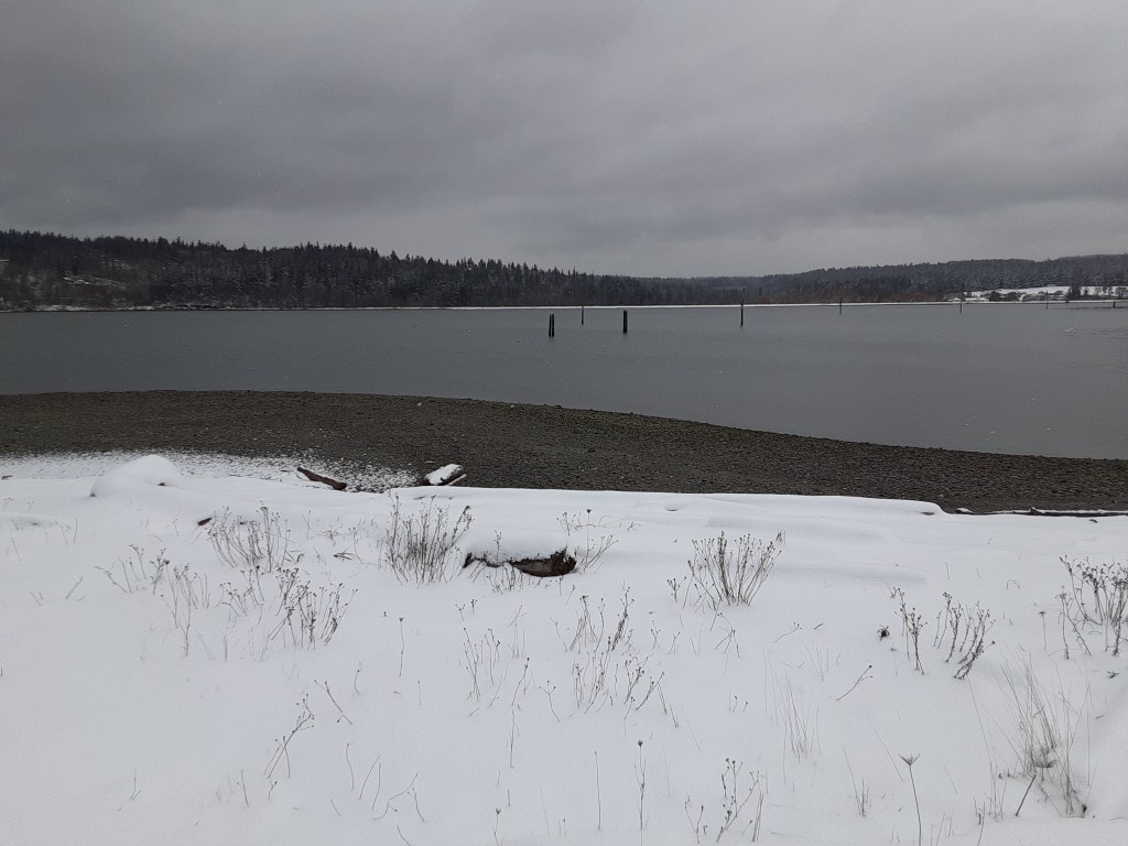
There are also several short, steep hills that are either officially or unofficially closed. Even the ferries are purposely operating a bit more slowly. Check the ferry alerts at times like this. One thing that hasn’t been mentioned but is worth considering. If the roads are too risky, maybe use a boat instead? Just be careful on the docks. It snowed there, too.

In the meantime, here are a few photos from one neighborhood.
One other thing that makes this storm a bit more peaceful is the power. The power has stayed on which means the generators have stayed off. It has been a sweet time to walk the neighborhood, talk to folks, watch kids sledding, adults trying to ski, and enjoy snow falling and maybe snowballs flying.