
Two visitors hiked across the island and stopped at Possession Beach Park with a question; “How far can we walk along the beach?” Good question. A great supply of answers: a few hundred feet, or over a hundred miles, or it depends.
For legal reasons, check who owns it; but we’ll get back to that.
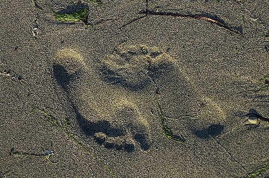
The geographical answer is partly logistical. It depends. There’s a lot of sand and plenty of pebbles out there. At low tide, almost all of the island’s beaches are walkable. Before roads were cut through the forests and across the prairies, the beaches were the easiest way to get from one community to another. There was no need to specify whether they were beach communities because almost every community was on the beach. At high tide, be glad modern technology can provide a forecast for how high the tide will rise. It’s possible to get caught with water on three sides, and maybe lapping into your shoes, while a big, sandy bluff stands above you.
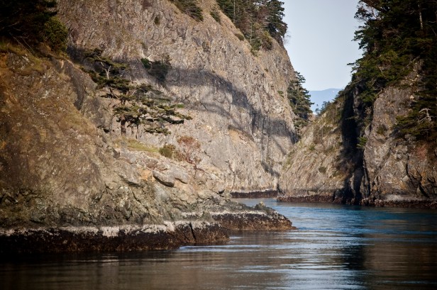
There are a few places where some wading can significantly shorten a walk. Just don’t be surprised if splashing through the water surprises some aquatic critters. Deception Pass is one of the few places where cliffs get in the way. Of course with the right rock climbing skills…Nah. That’s not a good idea.
 Oh, why wait. Let’s get to the biggest impediment to walking the beaches: lot lines. Before we started drawing lines on maps, no one owned the beaches. Then, people showed up; and for probably thousands of years the beaches were claimed by various tribes, but the population was sparse and the plenty was plenty. Then came the map makers, the planners, and the developers. Someone at the start was smart.
According to WaterHavens; “Washington State, through Article XVII of its constitution, asserted ownership to the “beds and shores of all navigable waters in the state…” so that no one could monopolize the major means of transportation, trade or fishing areas.”
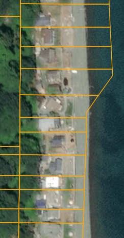
Now, lot lines radiate to the shoreline, and sometimes beyond; each parcel with a specific owner. Depending on when the land was settled, which laws were in place or being enforced at the time, and where the sand has shifted can determine whether that beach is private, public, or very confused. There’s enough confusion that don’t be surprised to learn that some passionate disagreements persist, which you might hear if you step past someone’s imaginary line.
Many residents don’t care. Stay out of their yard, don’t make any noise, don’t park in their spot, and maybe leave the fish and clams alone. Stay near the low tide line and you might get by fine. Footsteps in the sand are erased by the tides. Tire marks in someone’s turf don’t heal as quickly. Some less polite folks give some homeowners sufficient reason to be protective. Simply said, be polite, ask for permission if possible, and be ready to turn around if requested. Keep those tides in mind in that case.
One place where geography may be inviting but the turn around is required instead of requested is the Navy land. The Navy has a lot of land. (There’s an irony.) Not surprisingly, the military doesn’t want surprises on their shores. If you want to finish some epic circumnavigation, give them a call. It probably won’t be the first time someone asked. They probably have an answer.
Another way to mark the level of discussion about who can walk where is demonstrated by the existence of organizations like Island Beach Access. They advocate for the enforcement of public access to Whidbey Island’s beaches. They’re busy, and some of the fights take years. They’re one way to better understand which invisible lines are most sensitive, and in some cases, which invisible lines have (possibly illegally) been replaced with very visible walls and fences.
 For most people, though, a beach walk is an morning or afternoon excursion. An hour or two of walking the sand and pebbles is enough. Tides don’t change as much in an hour as they will in a cycle. It’s relatively easy to keep track of where you started in case you have to return. With a bit of planning, it’s also possible to start at one spot, end at another, and get a friend to drive you back. A good list of places has been compiled by the state. The list includes over 80 places that at least suggest access to the water. It’s up to you to research a bit about which places work for you.

Pick the right path and find yourself walking along a natural beach with an abundance of sea shells, clam spouts, gulls and herons and crows and eagles and osprey, driftwood logs large enough to build houses from (but leave them in place), views, and if you’re lucky you might find old mammoth bones or recently departed whale vertebrae. There are places that have only changed naturally, as waves wash cliffs, spreading the sands and pebbles out into broad shelves edging deep drops into depths with kelp beds and giant octopus.
How far can you walk on Whidbey’s beaches? Far enough that some people spend years trying to cover it all.

